…You can get around it by completely changing the rotation of Antarctica/Australia, such as:
But that rotation is not standard and I think probably for good reason. and it’s still not perfect according to these isochrons. It does however close up quite nicely going back to Pangaea: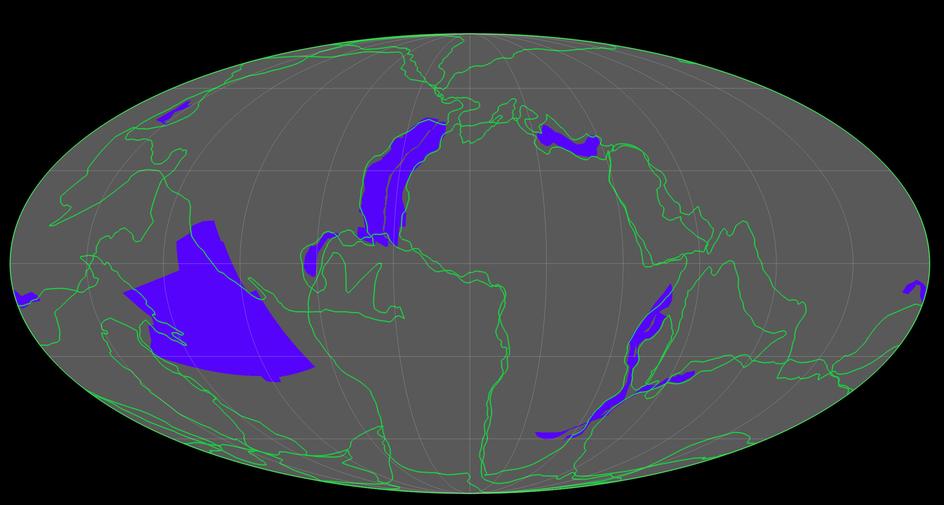
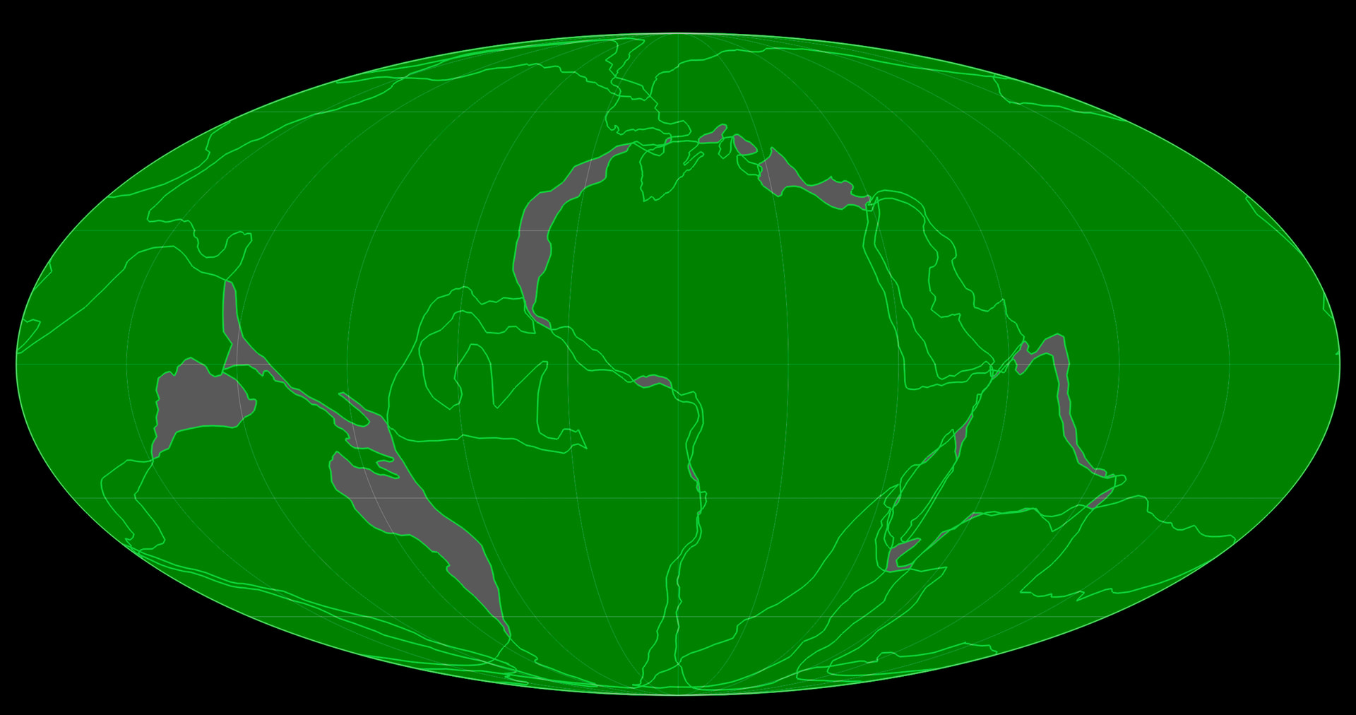
It is standard on any Pangaea model that there have been continental deformations, particularly along the Pacific coast. Most of my overlaps are standard without deformations applied, for instance the Central America overlap. But, it’s hard to imagine deformations as dramatic as what would be needed to resolve the mis-fit of Australia up inside east Asia. Paleo Australia, Antarctica, and the Pacific are persistent problems on a small Earth model and that’s kinda the only spot that matters because its the one region that isn’t already connected on a standard Pangaea model, so its needs to work. Maxlow, and Neal Adams get around this with what I think are cheats. Maxlow not only does some questionable rotations (although plausible) but fills the South Pacific gap (and others) with extended crust that was somehow over-taken by ocean spreading, and I don’t understand how that is supposed to work. Adams just rotates Antarctica in a way totally inconsistent with the seafloor record. I wanted to do my own small Earth following a principled approach but at the moment the only way I can make the fit is with this questionable rotation of Antarctica. There are, however, some very intense patterns in the fracture lines along the South Pacific and south Indian Ocean that do suggest an extreme rotation of Antarctica/Australia so I think there’s reason to keep improving the model.
I’m going to make some more complex models that incorporate continental deformation plus compare different isochronic mapping data and do it with a 10 or 20myr resolution; and make more use of fracture lines and hot spot trails as guides, and see where it all goes. If you have any insights on this or questions please let me know, and please keep posting if you have anything new to share!
Also, I made this isochron-based animation of a fixed-Earth reconstruction (including that Antartic/Australia rotation):
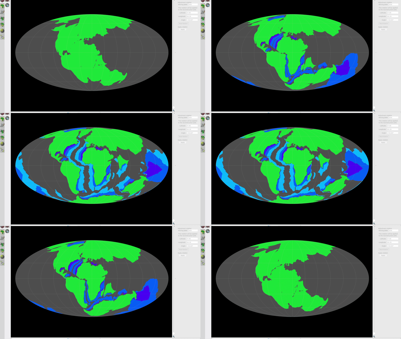
I think doing it this way frankly makes a better paleo-reconstruction, and it really does seem to suggest expansion. It was looking at it this way - that blooming rose petal effect - that played a huge part in getting me into Expansion hypothesis in the first place.
Cheers.
Thanks — below was written by ChatGPT then edited by me.
On the viewer: the page you saw is basically just a GeoJSON viewer. Once a file is loaded, the features are not freely movable in the way they would be in a drawing program. The coordinates are already baked into the GeoJSON, so the viewer is just rendering them where the file says they go. I can rotate the globe, turn layers on and off, change views, compare files, etc., but I cannot just grab Australia or Antarctica and drag it around inside that viewer.
What I can do is ask AI / scripts to rewrite the GeoJSON coordinates and generate a new file. So the workflow is more like: inspect the geometry, identify what needs to change, then have the coordinates transformed, morphed, split, repaired, or reprojected into a new GeoJSON. Then I reload that new file and see what happened.
That is also why I built a separate clicker-type tool. The page you saw is not really the clicker app (I think). The clicker app is more of a diagnostic / control-point tool. It lets me mark coordinates, click features, snap to line segments, pair features between two files, and export those clicks as JSON instructions. Then those clicks can be used by AI/scripts to rewrite the underlying GeoJSON more intelligently.
You can try the viewer here:
https://expandingearth.science/wireframe3
Right now it is still mostly a viewer, not a full editing program. But if the map-style view you’re using would be helpful, I can probably add that as another mode. It would make sense to have a 3D globe view, a normal 2D map view, and maybe a side-by-side comparison view (why did it never suggest this previously?) for exactly this kind of reconstruction problem.
On the Antarctica/Australia issue, I don’t really have a position on that. My view at is that the seafloor isochrons are the roadmap. Any proposed movement, rotation, deformation, or fit has to make sense against the isochron pattern, fracture zones, and spreading history. I still haven’t been able to get any AI system to work it all out yet.
There is a continent-size issue that I can point out. At the oldest frame, a 2D fixed-Earth-style reconstruction is going to depict the continents as too small relative to the smaller globe being modeled. On a smaller Earth, the same continental crust occupies a much larger percentage of the total surface area. Since surface area scales with radius squared, reducing the radius means the continents should cover much more of the map.
So if the continents are carried over with roughly modern/fixed-Earth map footprints, they are underrepresented in later scenes. By the end, essentially the whole map should be filled. That makes the remaining gaps look artificially large. Some of the apparent South Pacific gap may therefore be a real fitting problem, but some of it may simply be that the continents have not been allowed to occupy the share of the smaller globe that they should occupy.
That is what I’m trying to work through now: not just rotating pieces until they look better, but rebuilding the frames so the isochrons guide the reconstruction and the continental crust is represented at the correct relative size for each smaller radius.