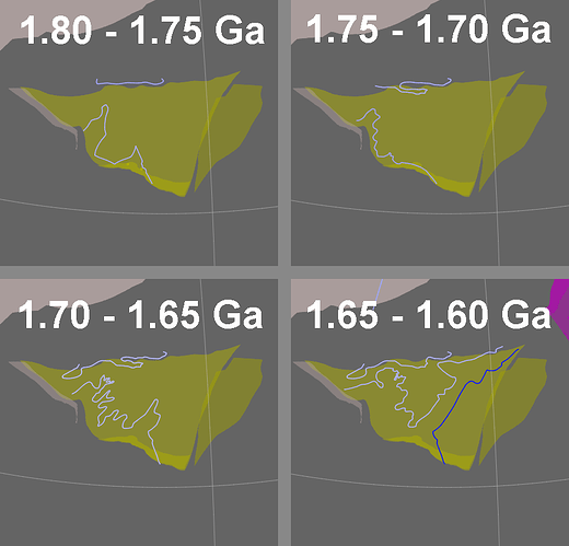
I’m interested in making shoreline and continental flooding maps, similar to those published by Scotese and others, but for Precambrian times. There are a lot of reconstructions of tectonic geography in Precambrian times (i.e., the positions and movements of the continental blocks), but there are few lithofacies maps that depict, for different time slices, what parts of those continents were actual emergent land and which parts were submerged continental shelves.
As an example of the kind of data I’m looking for, I did find lithofacies maps of North China for the period between 1800 to 1600 Ma, which depict marine transgression and the formation of a seaway through the craton. I imported these maps into GPlates and digitized the boundaries between terrestrial and marine environments, which I took as the shorelines.
Could anyone here find or share other Precambrian facies maps like the ones I linked to, for other parts of the world, and for other time slices? It would also be greatly helpful to have data points like fossil localities to further constrain shoreline positions.
Thank you for your support. It means the world to me that there are other people in this community who are willing to offer help.
- Samuel P. (graniterhyolite)
