Hi, I would like to ask how I can open a GPML file containing plate velocity data in ArcGis or Qgis so that they appear as vectors. Thank you.
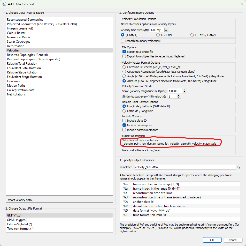
It might be easier to export to GMT (.xy) for velocities since the format is a lot simpler (each line is just 4 values: point longitude/latitude and velocity azimuth/magnitude). But I’m not sure how to import that into another GIS. Might have to first convert to a Shapefile if the GIS cannot import directly from a row/column text file. Then, in the GIS import, you could map the point longitude/latitude and velocity azimuth/magnitude attributes appropriately for viewing velocity vectors at points in that GIS. One option to convert to Shapefile, if needed before importing, is shown here using geopandas (where they map the x and y columns to 2D points - in your case you could name the columns lon, lat, azimuth, magnitude and the x/y would be lon/lat).