Hi Space_Lemon,
That’s an interesting use case. It sounds like you want to do a shift (or rotation) of the entire raster at present day. I recall in a previous post of yours that you only work at present day, so there’s no need to carry this shift into the past (although I also show a solution to that at the bottom of this post).
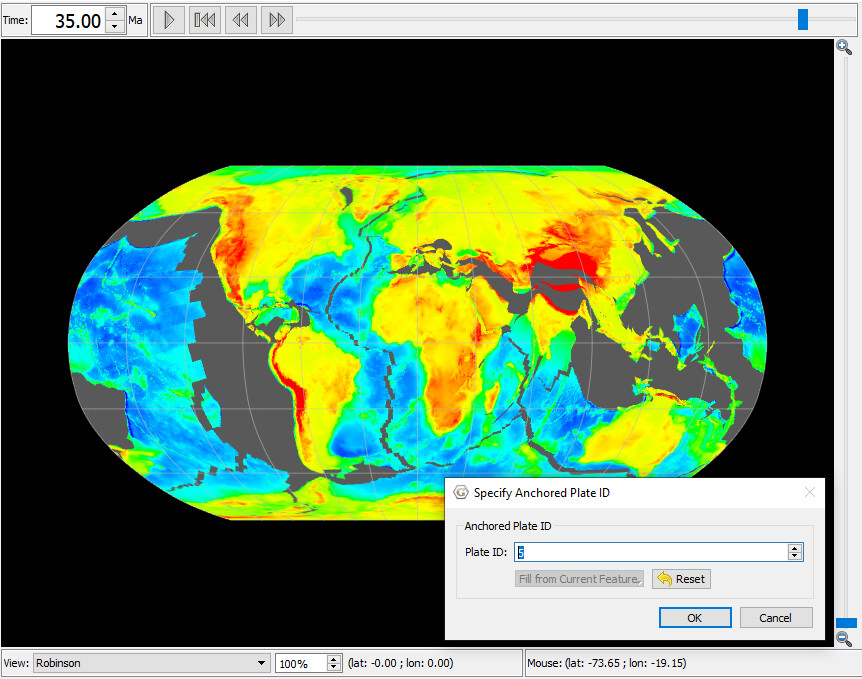
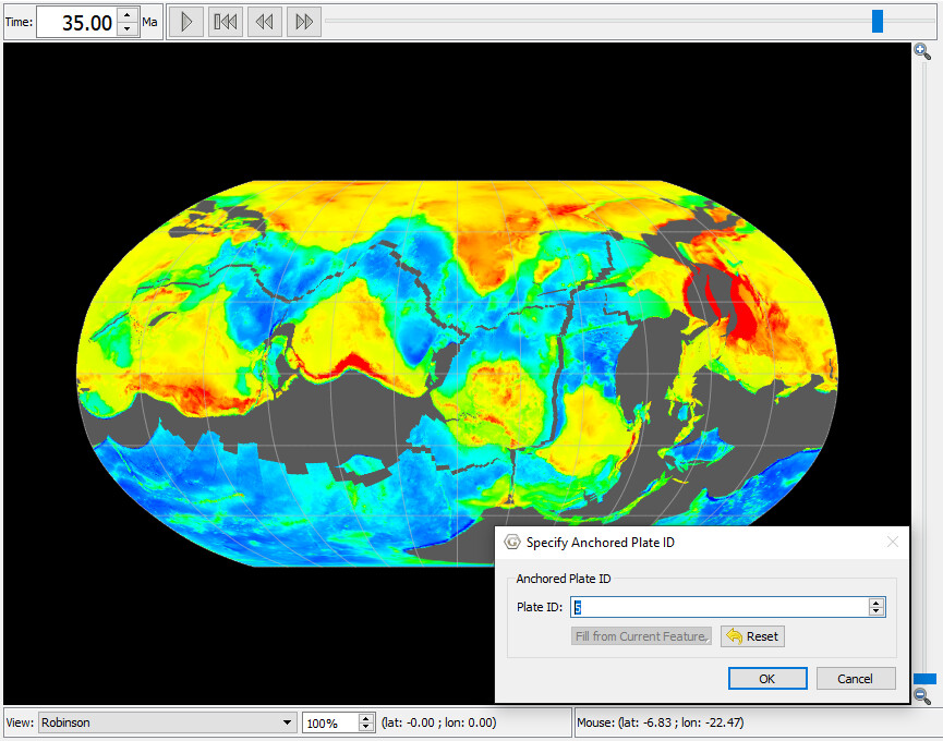
Perhaps the easiest solution is to reconstruct a raster using static polygons as usual (see the tutorial 3.2 on rotating rasters), but modify the Africa rotation at present day to be a non-zero rotation which would be your shift.
Here’s what I did by changing the Africa (701) zero rotation at present day:
701 0.0 90.0 0.0 0.0 000
…to non-zero…
701 0.0 0.0 105.0 -75.0 000
…in the rotation file.
Here I’ve introduced a rotation with a pole at latitude 0.0 and longitude 105.0 that rotates 75 degrees clockwise around that pole. The pole is on the equator roughly 90 degrees away from the centre of Africa and so rotates the centre of Africa upwards so that it’s roughly over the North pole.
You can see that Africa is all mashed up at the North pole…
Note that this only works at present day (which is OK for you). As soon as you go into the past then things gradually settle back to normal (ie, as if you had never introduced the change). In order to keep the shift into the past, the easiest approach would be to introduce a new plate ID between Africa and 000 and put your shift there. For example, introduce some unused plate ID like 005, then just change all occurrences of 000 in the rotation file to 005, then introduce a 005-relative-to-000 rotation sequence and have it be a constant shift over all time, as in…
005     0.0   0.0    105.0    -75.0  000 ! DC shift
005  1000.0   0.0    105.0    -75.0  000 ! DC shift
Using an extra plate ID (005) means all plates gets shifted equally without affecting the relative rotations between plates (like South America moving relative to Africa).
Then your raster will continue to reconstruct normally into the past while also maintaining the constant shift…
And setting the anchor plate to 005 would return things to normal (ie, no shift) because you’re essentially bypassing the 005-000 shift…
In fact, even easier is to keep your original rotation file (ie, don’t bother changing all occurrences of 000 to 005) and just introduce a 000-relative-to-005 rotation sequence…
000     0.0   0.0    105.0    -75.0  005 ! DC shift
000  1000.0   0.0    105.0    -75.0  005 ! DC shift
…noting that I’ve reversed the order of 000 and 005 (from before).
In this case setting the anchor plate to 000 (default) keeps things as normal (as if you’d never made a change) because it’s essentially bypassing the 000-005 shift. And setting anchor plate to 005 brings about the shift (eg, Africa moves relative to 000 which in turn moves relative to 005 thus introducing the shift)…
Regards,
John