I am trying to import a shp point map that has an attribute column set to “Volcano” or “gmpl:Volcano” (I tried both), which I use as Feature Type, but once it is imported, the Feature Type becomes “UnclassifiedFeature”. I read somewhere that a two letter code is expected here, but where can I find the code for Volcano (and other features) ?
I can change the Feature Type by editing the feature, but I have almost 4000 of them !
Thanks for your help !
Denis
Hi Denis,
that has an attribute column set to “Volcano” or “gmpl:Volcano”
Is this the attribute name Volcano or gpml:volcano or the actual value of the attribute field of the individual feature?
I’ve tried a few things with a volcano file I had lying around and I can confirm the following:
- Setting the column (attribute) name to
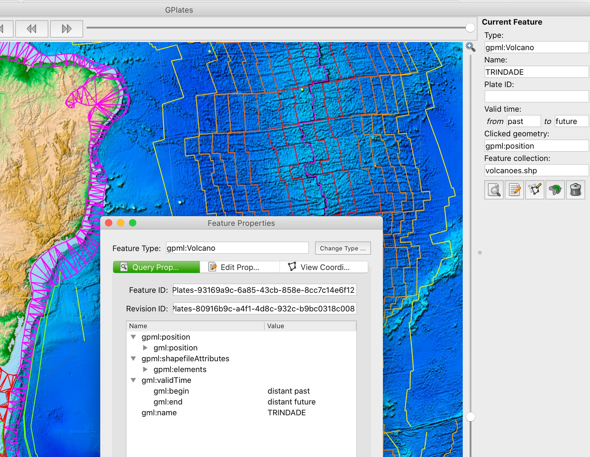
GPGIM_TYPEand the attribute value toVolcanoas per GPGIM then importing the file into GPlates and setting the attribute mapping ofFeature typeto theGPGIM_TYPEattribute works for me. See here:
- Now - the interesting part is that using a different attribute name (e.g.
gpmltypeorfeaturetype), assigning agpml:VolcanoorVolcanoas value for each feature, and chosing this attribute name in theFeature typemapping doesn’t seem to work. Maybe this is a borderline bug @john.cannon - I would expect that when I make an explicit mapping ofFeature typeto attribute name in the import wizard for a SHP file that GPlates should then be able to check the attribute value as to whether it is part of the GPGIM or not and do the feature type assignment. I cannot recall whether it is mandatory to name to columnGPGIM_TYPEin order to get GPlates to make the proper mapping and feature type assignment.
n.b. - this is with GPlates 2.3
Hope this helps,
Christian
Great ! Now it works ! The important thing is that the name of the attribute column of the shp file must be GPGIM_TYPE . Many thanks for your help !
Denis
I think if you want to use the full feature type (such as Volcano or gpml:Volcano) in your Shapefile then you must name your attribute column GPGIM_TYPE (I just checked the source code), otherwise GPlates will expect the 2-letter equivalent (eg, VO for Volcano) from the PLATES-format days. You are right in that GPlates should probably check both though (something to look at during the overhaul of the OGR-related code).
Also I believe on export GPlates writes out two columns, one is GPGIM_TYPE containing the full feature type and the other is TYPE containing the 2-letter equivalent.
Here is the current 2-letter mapping in GPlates…
	map["AR"] = "AseismicRidge";
	map["BA"] = "Bathymetry";
	map["BS"] = "Basin";
	map["CB"] = "PassiveContinentalBoundary";
	map["CF"] = "ContinentalFragment";
	map["CM"] = "PassiveConinentalBoundary";
	map["CO"] = "PassiveContinentalBoundary";
	map["CR"] = "Craton";
	map["CS"] = "Coastline";
	map["EC"] = "ExtendedContinentalCrust";
	map["FT"] = "Fault";
	map["FZ"] = "FractureZone";
	map["GR"] = "OldPlatesGridMark";
	map["GV"] = "Gravimetry";
	map["HF"] = "HeatFlow";
	map["HS"] = "HotSpot";
	map["HT"] = "HotSpotTrail";
	map["IA"] = "IslandArc";
	map["IC"] = "Isochron";
	map["IM"] = "Isochron";
	map["IP"] = "SedimentThickness";
	map["IR"] = "IslandArc";
	map["IS"] = "Isochron";
	map["LI"] = "GeologicalLineation";
	map["MA"] = "Magnetics";
	map["NF"] = "gpmlFault";
	map["N1"] = "NavdatSampleMafic";
	map["N2"] = "NavdatSampleIntermediate";
	map["N3"] = "NavdatSampleFelsicLow";
	map["N4"] = "NavdatSampleFelsicHigh";
	map["OB"] = "OrogenicBelt";
	map["OP"] = "BasicRockUnit";
	map["OR"] = "OrogenicBelt";
	map["PB"] = "InferredPaleoBoundary";
	map["PA"] = "MagneticAnomalyIdentification";
	map["PC"] = "MagneticAnomalyIdentification";
	map["PL"] = "Pluton";
	map["PO"] = "PoliticalBoundary";
	map["PM"] = "MagneticAnomalyIdentification";
	map["RA"] = "IslandArc";
	map["RF"] = "Fault";
	map["RI"] = "MidOceanRidge";
	map["SM"] = "Seamount";
	map["SS"] = "Fault";
	map["SU"] = "Suture";
	map["TB"] = "TerraneBoundary";
	map["TC"] = "TransitionalCrust";
	map["TF"] = "Transform";
	map["TH"] = "Fault";
	map["TO"] = "Topography";
	map["TR"] = "SubductionZone";
	map["UN"] = "UnclassifiedFeature";
	map["VO"] = "Volcano";
	map["VP"] = "LargeIgneousProvince";
	map["XR"] = "MidOceanRidge";
	map["XT"] = "SubductionZone";