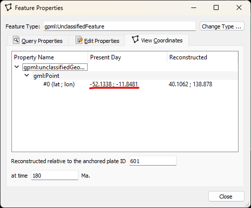
I had another look at this and I think the reason is your lat/lon location (ie, 41, 137) is a reconstructed location whereas it needs to be the present day location.
If I digitize a point at 180 Ma at the lat/lon location roughly (40, 139) and give it plate ID 926 (note that I’m also using anchor plate ID 601 when digitizing), then I can query the present day location to get…
I then enter that into the Kinematics Tool to get…
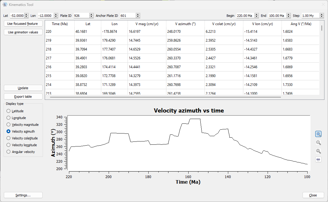
…which is a lot closer to the red points in your graph. Although from 140 Ma to 100 Ma it doesn’t match as well, but that’s because the azimuth is highly dependent on the reconstructed location of the point location (since the velocity depends on the point location relative to the velocity rotation pole). So I might not be using the same point location that you used (when you exported your reconstruction snapshots).
So I think this probably explains the discrepancy you’re seeing.