Dear folks,
I am trying to obtain velocity azimuths and magnitudes of the Izanagi oceanic plate (ID 926) relative to the (anchored) North China Craton (Plate ID 601) for the period of 220-100 Ma, along their convergent margin at Lat 41 and Long 137. For this, I use GPlates 2.5.0_win64 and the Plate Motion Model of Zahirovic et al, 2022.
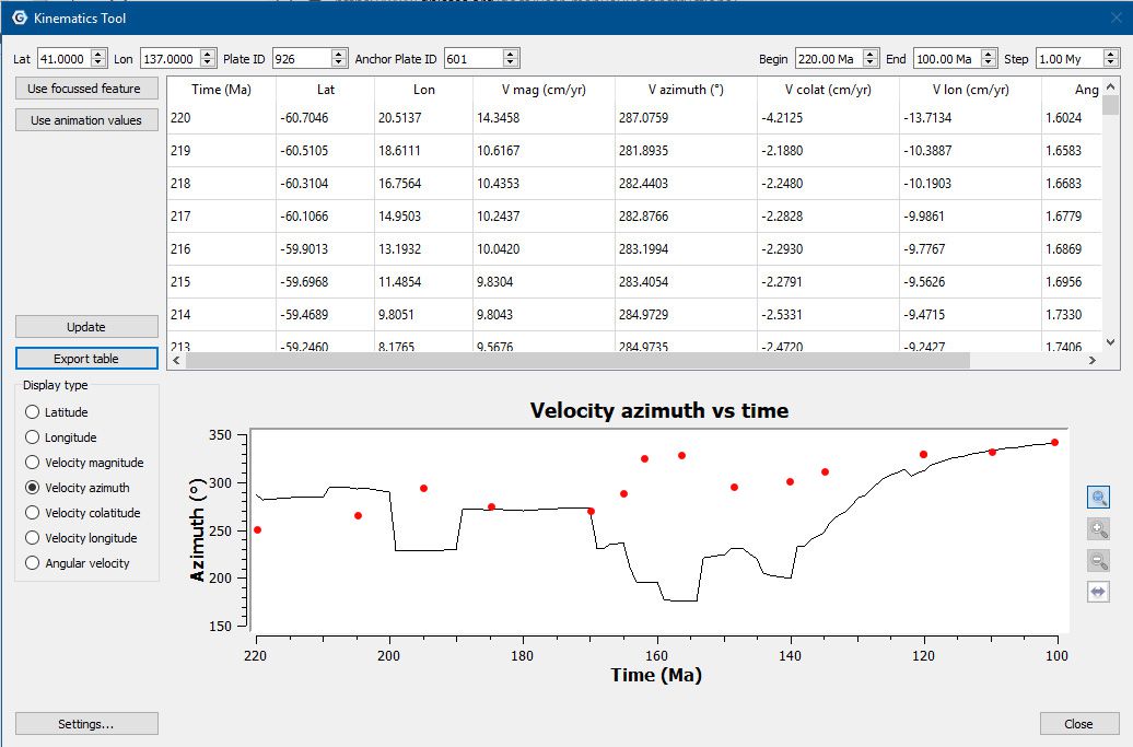
The problem is in the discrepancy between the results observed in the reconstruction snapshots and the Kinematics Tool. The velocity azimuths observed in the reconstruction snapshots (marked with red dots) do not match those plotted and listed in the Kinematics Tool, as you can see in the attached images.
It seems I am using the Kinematics Tool incorrectly for this task. The convergence of oceanic and continental plates is not covered in the GPlates manuals and tutorials. I will be grateful for your suggestions on how to get the correct velocity azimuths and magnitudes in numerical and graphical forms for such a case.
It might be mis-matched delta times (used in the velocity calculations).
The reconstruction snapshot uses 1 Myr and I believe the Kinematics Tool defaults to 5 Myr. You can try changing the latter to 1 Myr (in Settings... in the Kinematics Tool).
Dear John, Thank you very much for your reply.
In this case the time step in the Kinematics Tool was also set to 1 Myr.
And the azimuths sometimes differ by 150+ degrees
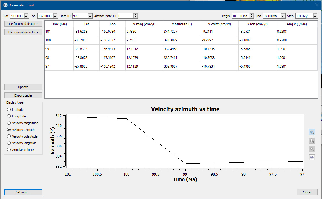
Playing with Gplates I found some inconsistencies with the velocity azimuths in the Kinematics Tool and snapshots.
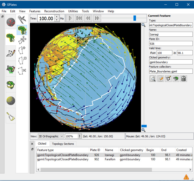
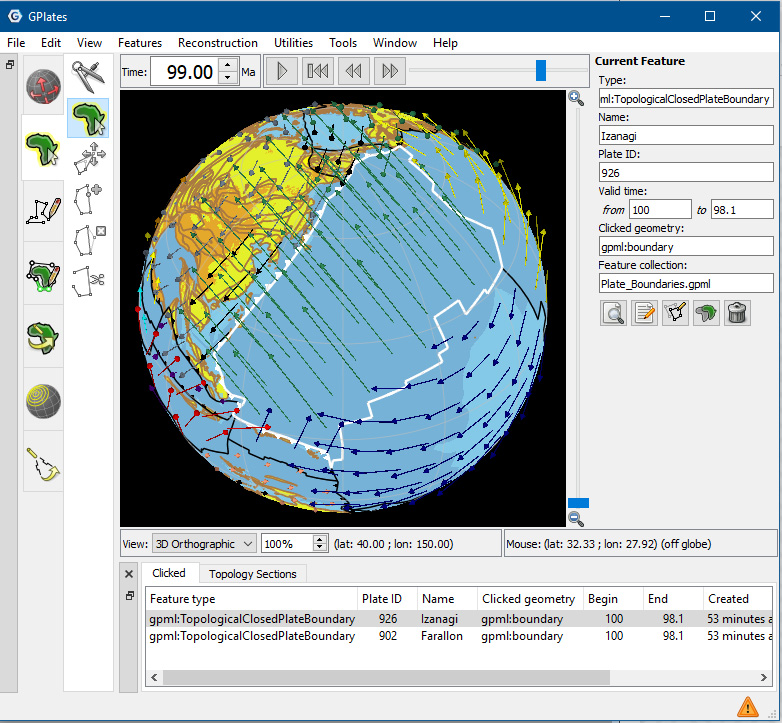
Another example for the Izanagi plate at 100 and 99 Ma, with anchored plate ID set to 0 and time step to 1Myr.
The azimuth for 99 Ma increases in the snapshots and decreases in the Kinematics Tool, in both cases for about 10 degrees.
What could be wrong here?
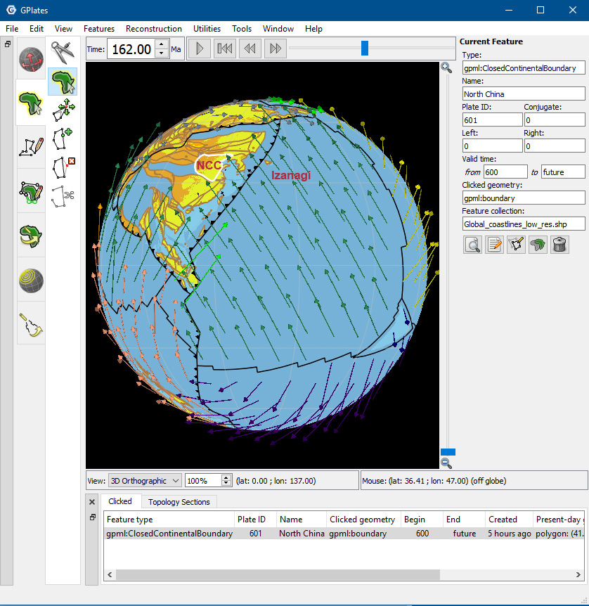
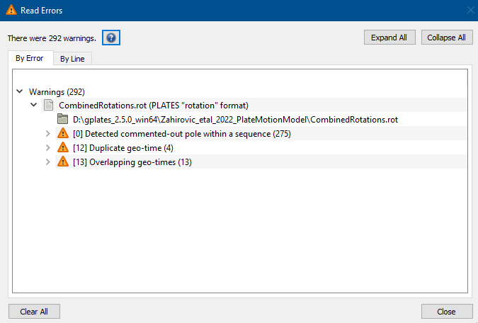
Must say, I have got some error warnings after aploading data set of Zahirovic et al., 2022, including [0] detected commented-out pole within a sequence (275).
Could this be the reason for the GPlates misbehavior?
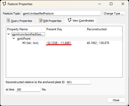
I had another look at this and I think the reason is your lat/lon location (ie, 41, 137) is a reconstructed location whereas it needs to be the present day location.
If I digitize a point at 180 Ma at the lat/lon location roughly (40, 139) and give it plate ID 926 (note that I’m also using anchor plate ID 601 when digitizing), then I can query the present day location to get…
I then enter that into the Kinematics Tool to get…
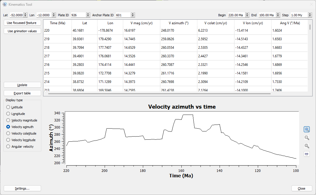
…which is a lot closer to the red points in your graph. Although from 140 Ma to 100 Ma it doesn’t match as well, but that’s because the azimuth is highly dependent on the reconstructed location of the point location (since the velocity depends on the point location relative to the velocity rotation pole). So I might not be using the same point location that you used (when you exported your reconstruction snapshots).
So I think this probably explains the discrepancy you’re seeing.
Dear John, thank you so very much for your time and efforts in finding the explanation of this discrepancy. Yes, the kinematics tool works a lot better with a present day location of the point digitized in the reconstruction image. It seems that the kinematics tool should be used this way numerous times in order to get a sequence of velocity azimuths and magnitudes of the moving oceanic plate.