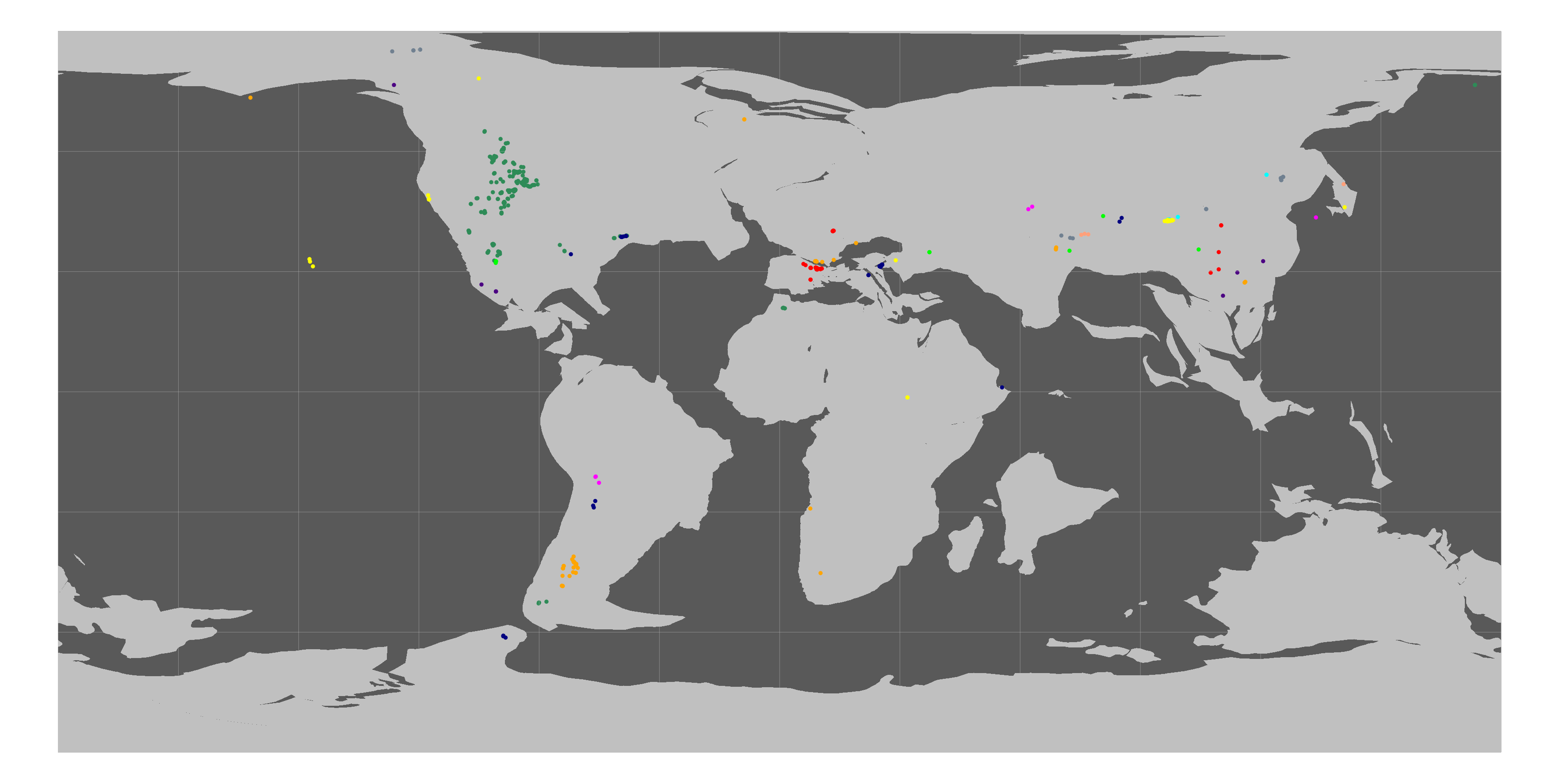
As shown in the attached figure, I have attempted to reconstruct the paleopositions of several dinosaur fossil localities using their shapefile data. However, some of the points are being projected into the ocean, and I have not been able to determine the cause of this issue. Would you be so kind as to advise me on what might be going wrong?
There are three possible causes:
- If you have used only the continental polygons to cookie-cut your dataset, then data points at localities underlain by oceanic crust will not be assigned Plate IDs. This is rare, but possible: some river deltas are underlain by continental sediments deposited on oceanic basement, and oceanic plateaus are often subaerial (above sea level) when young.
- The “Begin” time of a continental polygon (i.e., the geologic age at which it first appears on the map) typically represents the approximate age of consolidation of the continental crust bounded by the polygon; the block may contain rock units that are older. For example, most of the polygons making up Japan first appear at 30 Ma, but much of the Japanese archipelago is composed of Mesozoic and older material. Any Mesozoic data points falling within those polygons would be plotted over the background of your reconstruction, even if finite rotations are programmed for their Plate IDs that far back in time.
- Related to the second cause, rotations may not be programmed for a block’s Plate ID prior to the “Begin” time of that block. In that case, if GPlates finds no finite rotation poles for a certain ID at a certain geologic time, it will show the Plate ID unrotated in its present-day position, regardless of the fixed Plate ID you have set. (Check for data points that don’t move at all for at least part of your timeframe.)
Hope this helps,
Samuel