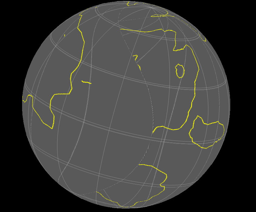
I have a problem when i import my rasters(robinson type) and they keep ending up looking something like this on the planet. can someone please help me try to make the import look like it’s supposed to?
Have you got the raster in any other projection? I don’t think GPlates handles anything other than equirectangular projection for rasters. If you don’t have an equirectangular projection for your raster image, there are applications that will convert projections with some degree of accuracy. The best such application I know of is G.Projector by NASA, and it supports Robinson projection for input images.
I tried gprojector but it didn’t work(i tried getting java, it still didn’t do the thing), are there any others that I could use?
Can you send me your raster? GPlates should be able to handle raster builtin projections (early versions couldn’t as Robbie pointed out).

Sorry it took so long to respond, but here. Hope to whatever’s above that you can somehow deal with this
Thanks, looking at your raster and your original screenshot I think I see what you mean. It seems you are exporting a screenshot from GPlates (in Robinson projection) and then importing it again.
While GPlates can import rasters with different builtin projections, an exported screenshot will not have a builtin projection (eg,saying that it’s Robinson) because it’s just a jpg or png for example.
The other problem with this approach is the exported screenshot captures the GPlates viewport and that will have empty space around the map, unless you manage to zoom and adjust the GPlates window dimensions to remove the empty space (but that’ll probably never be 100% accurate).
If you do use this approach then it’s better to switch to the Rectangular projection in GPlates before exporting the screenshot. But even better is to just keep the original features loaded instead of exporting a screenshot and re-importing, although maybe you have a reason for doing that.